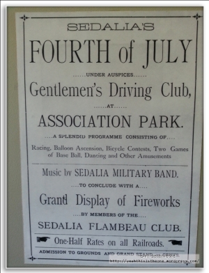
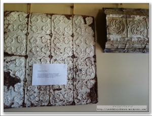
Katy Trail 2012, Day Four (Washington to Machens)
October 28, 2012
Day 1 (Clinton to Boonville) is posted here.
Day 2 (Boonville to Jefferson City) is posted here.
Day 3 (Jefferson City to Washington) is posted here.
We woke up around 7 AM and starting getting ready for our final day on the Katy Trail. A few times towards the end of day three I’d said to Mr. V, “You know, it’s all too easy to take this for granted, and I am very sure I’ll miss this when it’s over.” Here at the start of day 4, even with 50 miles left to go, I already was saddened that the adventure was coming to a close.
Above: Right out of the gate, weather was a question mark for the day. Weather.com’s hour by hour forecast showed us having a high probability of going through some rain anywhere around 10 AM to noon. We’d each packed a poncho like this one, which to this point we hadn’t needed; now, making final prep this morning in the hotel, I moved mine to the top of the “clothes” pannier.
Above: A last quick look back at the room. My panniers and helmet lying on the bed.
Above: Our bikes waiting patiently outside the hotel for the same guy to pick us up who’d dropped us off the night before. This morning we had the Super 8 complimentary breakfast, and again wiped down and re-oiled our chains.
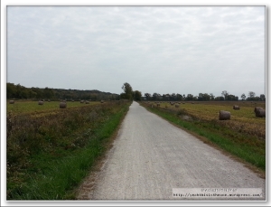
Above: Katy Trail 2012, day 4. 190 miles down, 50 to go.
Note that it was actually warm enough this morning that we were both rocking the short-sleeved shirts. Very pleasant morning.
Above: I distinctly remember this point near the start of this morning’s ride. I was trying to purposefully soak it all in and internalize the great times I’d had the past few days. I was all too aware that with the short day today, and a likely tailwind at our backs, we’d be in Machens before we knew it and this trip I’d had in my blood for a year would, very strangely, be over.
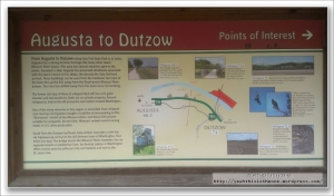
We reached Augusta, about 8 miles from the Dutzow trailhead that was our starting point after the taxi dropoff.
One thing we noticed right off the bat this morning was that we were seeing many more folks on the trail than the first few days. This was partially attributable to getting closer to St. Charles; partially attributable to going through wine country which attracts a lot of riders on the trail; but mostly, I suspect, because it was the weekend – Saturday. The majority of riders (and a number of joggers and walkers) we encountered were headed from east to west, but a fair number were also going in our direction. We had some pleasant conversations with cyclists at several consecutive trailheads along the way. Spoke with several folks who were also doing the full trail, mostly in 5 or 6 days. Very nice folks on the whole.
We reached the Matson trailhead, passing many cyclists on the way and speaking with several of them.
Above: You don’t see this every day. This was right at the Matson trailhead. When we first arrived, there were only 3-4 of them, all in varying superhero costumes. But within 2 minutes of our arrival, a good half dozen more arrived from the east. They were all touring wine country, each of them dressed in a superhero theme. Pretty cool. They asked Mr. V to take their picture with their camera, and graciously posed for me to take theirs for the blog. Guys, if you’re reading this somewhere, good work!!
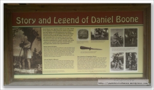
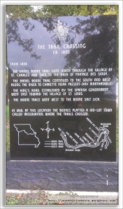
Above: The Daniel Boone Judgment Tree Memorial, just across from the Matrson trailhead.
Above: We stopped at Terry & Kathy’s bar & grill in Defiance, MO for lunch. A nice enough little bar & grill just off the trail. I once again had a bacon cheeseburger, with fries and a lemonade that was to kill for. We ate on the deck outside and could literally watch several feet away as folks flew by on the trail, with some getting off here to eat where we were or a nearby place.
Above: The very-well-graffiti’d wall of the men’s room.
About three miles past Defiance, we reached Weldon Spring.
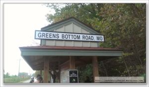
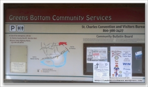
We reached Greens Bottom trailhead. I don’t retain particularly warm memories for this portion of the ride, because at this trailhead we encountered a group of boisterous and downright profane “young uns” who were notably more interested in where they could acquire more alcohol than in any of the natural and historic interest around them. Plus the restroom at Greens Bottom was, no exaggeration, probably the most disgusting restroom I’ve ever been in in my life. If the human feces out in the open and the nauseating smell attracting hundreds of nasty little bugs didn’t get you, then the overpowering smell of bleach – so potent you could smell it from several feet away before you even opened the restroom door – probably would. This was the one and ONLY black eye on what was an amazing four days.
The ride was nearing an end. I’d been getting texts from friends over the past few hours asking where exactly we were; they were asking in regards to the weather, which it appears we always just slightly outran. The impression I got from friends’ texts and talking to them later is that the weather (lots of rain) was following us up the trail but always just behind.
It seemed pretty clear now, with trailside info-boards referring to St. Charles, that we were going to avoid rain altogether. Mr. V and I found it funny that the very near-term forecasts (only 6 hours into the future!) of two reliable weather forecasting services could be so divergent. We were both glad Accuweather had won that particular battle.
The tailwind we’d been expecting did show up, however. It was the strongest wind of the entire four days, and happily, it was at our backs (or a cross-tailwind) for 90% of the time. With the benefit of that, plus trying to outrun the rain, plus targeting a rendezvous with Mrs. V who was going to drive to Machens from KC to pick us up, we were making fast time on the bike.
We set a 4:15 pickup time with Mrs. V. Machens as the end of the trail just dumps you out in the middle of nowhere, so Mr. V put a premium on our arriving ahead of Mrs. V so that we could guide her in, versus the possibility of her just wandering around unsure if she’d reached the destination or not.
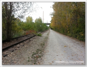
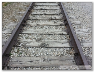
Above: As we neared St. Charles, the old railroad tracks began to reappear alongside the trail. Another (and among the last) of the familiar echoes of the past. It was interesting to me to note how nature is gradually reclaiming it for her own – plants growing in among the slats and filling out. Very interesting commentary on the impermanence of even extraordinary things.
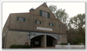
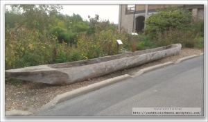
At St. Charles we encountered the Lewis & Clark Boat House and Nature Center just before the trailhead. Following are several pictures from this interesting little area.
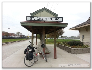
We left this cool little place and proceeded to the actual St. Charles trailhead.
Above: Pushing back from St. Charles bound for Machens. Roughly ~225 miles were down, 12.6 to go. With the looming rendezvous time with Mrs. V, Mr. V and I more-or-less sprinted to the finish – which was exhilarating and fun. In the process, however, I took note a few times that I really liked this last 12 miles, a feeling Mr. V shared. The first mile or two after St. Charles was pretty drab, but after that, the final 10 or so into Machens were pretty cool. One thing I liked about it is that it seemed to me to have a quite different flavor from any of the previous 225 miles. Factoring in that this Machens extension has been open only 18 months, with St. Charles previously being the end of “what was known”, this final stretch struck me as maybe like some amazing previously-unheard little passage of music in some recently-unearthed demo version of an old favorite song – new, different, and yet the same.
Above: About 3 miles west of Machens is the last (very small) trailhead prior to the end. Black Walnut. Snapped a couple pictures and hopped back on the bikes for the final run.
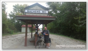
Above: We started 4 days earlier at Clinton, the western terminus of the Katy Trail State Park. Now at 4:15 PM on Saturday, we’d arrived in Machens, the eastern terminus.
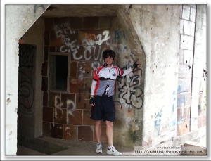
Above: Our “triumphant” picture. We did it!!
Mrs. V’s van is visible in the background. The timing literally could not have been better. Just through that guardrail you emerge onto a gravelly, rocky road. You go a very short distance – 1/8th of a mile maybe – and turn right onto another road. This other road is where many Katy travelers who are fortunate enough to have a pick-up in Machens, arrange to meet them.
There was another group waiting at this same place for their pick-up also. It was uncanny: they had left Clinton a day earlier than we had – Tuesday – and been traveling to Machens. We evidently had been gaining slightly on them throughout the week but never saw them – not even on the final 10, 15, 20 miles into Machens – until this pickup point. And yet, their ride came down the road to meet them literally 30 seconds ahead of Mrs. V’s van who was on the way to meet us. And all of this occurred within less than 2 minutes of us arriving at the pickup point. It was like a scripted ending.
And a heartfelt THANK YOU! to Mrs. V for picking us up out there.
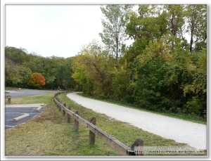
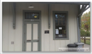
Above: A last look back at the Machens trailhead from “the other side”. A goal a year in the making had come to pass. I felt exhilaration, excitement, fatigue (not much), triumph, wistfulness, sadness – you name it, a Rubik’s Cube of emotions. One thing I knew for sure – I had had an amazing time; the Katy Trail had surpassed every expectation I had; and I already could not WAIT to do it again.
Mr. V was of the same accord. We’ve already begun plotting for our 2013 encore. Tentatively planning to do it around the same period in October.
Thanks for reading.
Katy Trail 2012, Day Three (Jefferson City to Washington)
October 28, 2012
Day 1 (Clinton to Boonville) is posted here.
Day 2 (Boonville to Jefferson City) is posted here.
My experience and that of Mr. V overlapped to a remarkable extent during the 4-day trip. Even though day 2 was possibly our shortest day, both of us were actually more tired at the end of day 2 than we were to end any of the other days. Several reasons were posited, but it’s nice to speculate on it now, in the comfort of hindsight. At the time, living the reality, I arrived at Jeff City on not too much more than fumes and was internally (and quietly!) wondering how on earth I could swing the roughly 75+ miles which day three would require if I was feeling like this now.
Fortunately, time, a good night’s sleep, a good fueling strategy and determination cures many ills. I woke up on day 3 feeling refreshed and, having calculated my remaining miles versus remaining fuel, determined I’d budgeted my fuel conservatively on days 1-2 and could open up a little bit as needed. Day 3 in particular was going to be a long one, so I decided early to not play around and instead make sure I stayed very well hydrated and fueled. This was going to be trickier than I bargained for, as will be revealed.
Above: A nice big breakfast (continental breakfast at the Baymont) to start the day. I had already discovered one of the special joys of bicycle touring – your metabolism goes through the roof; you can eat generous meals and still (if appropriate, as in my case) lose weight.
Above: After breakfast, Mr. V and I wiped down and re-oiled our chains in the Baymont’s conference room, for the long day ahead. We were planning to re-oil the chains following each day of riding (as bikekatytrail.com rightly says, you and your bike WILL get dusty from the limestone trail dust) but both our bikes were still in good enough order after day 1, so that this is the first time we maintenanced them on the road.
Above: The dawn of another beautiful day…ready to hit the Katy Trail once again.
Above: The capitol building.
Above: A look down High Street toward where we’ll get back on the dedicated lane on the bridge and then ride the short few minutes back to the North Jefferson Trailhead.
Above: Katy Trail, day 3. 120 miles down, 120 miles to go.
We reached Tebbetts.
Both Mr. V and I look back on this day 3 as being the sheerest test of our resolve. For myself – our on-bike styles differ. I drink a lot of water. A LOT of water. I’m one of those cyclists for whom feeling comfortable on longer rides centers around good hydration. A friendly warning for those riding the end-to-end Katy – the water accommodations at the trailheads are much different on the eastern half (past Jefferson City) than the western half. While essentially every trailhead west of Jeff City (roughly every 9-12ish miles) has water, almost NONE of them east of Jeff City do. Specifically in the ~70 miles of our day 3, there was water at the North Jefferson trailhead (start of day) and then again at the Marthasville trailhead 66 miles away (end of day). No trailhead in between had water.
This isn’t some desert, of course – the informed cyclist has a few choices: Carry additional hydration with him/her relative to his/her habits, and/or stop at local businesses to request of those folks kind enough to top you up.
I hatched a plan to work with the water situation. Mr. V offered me one of his water bottles at Tebbetts (dude is a machine – I swear he can go 100 miles on 9 oz of water and one energy bar) but I declined his selfless offer. I imposed upon the very kind folks at some kind of mill to the south of the Tebbetts trailhead for some water. Luxury – they had a beautiful water cooler in the office and let me refill my two large (about 52 oz total) bottles. This would hold me till our lunch stop, where I’d refill again which would hold me till Marthasville.
The other factor testing our resolve today would be the wind. We’d eyed the 10- and 5- day forecast in advance of the trip and saw that this day 3 would be the hardest in terms of wind. A fairly respectable and building wind from the north and east – acting as a direct headwind at times and cross-headwind at others – would be in our face most of the 70 miles. As though to pile on, much of today’s 70 miles would be the most prolonged open stretches on the trail – several long stretches with either no tree cover at all, or no tree cover to the east, from which the wind was coming. The wind was never strong enough to make you actually stop or truly slow your progress in a critical way – but it was just strong enough to grind on you all day long and wear you out.
We reached the Mokane trailhead.
Above: Spider on the trailhead building at Mokane.
We didn’t take a tremendous number of pictures today, especially as compared with day 2. A combination of the long mileage ahead of us and the pitiless wind kept us in the saddle just putting one pedal ahead of the other.
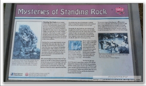
Above: At mile marker 120.4 is Standing Rock. This was another of the really awesome “time capsules” one encounters again & again on the Katy. I found it fascinating for many reasons. The board reads:
“Standing Rock looks like an isolated boulder that fell from above, but it is actually a remnant of the bluff that has resisted erosion. The rock is a fine-grained sandstone that may have formed when sand filled in a sinkhole or joint within the older dolomite, the primary rock of these river bluffs. But like similar ‘mystery sandstones’ in the Ozarks, its origin is unclear. Geology is not the only mystery surrounding Standing Rock: the identity of those who marked flood levels throughout the previous century on its face is also unknown.
Standing rock records water levels for at least seven floods: 1903, 1923, 1935, 1943, 1944, 1947 and 1993. The earliest record in 1903 marks a major June flood, one of Kansas City’s greatest natural disasters. Other notations on the rock are difficult to read. Although the trail here is more than a mile and a half from the river, it is still in the floodplain and vulnerable to the powerful Missouri.
Why would the Missouri-Kansas-Texas Railroad (known as the MKT or Katy) choose a location for its line that was so prone to flooding? A line with no grades and the fewest curves represents railroad perfection, and the Katy’s 165-mile-long Machens to Boonville section approaches that ideal.
The decision was risky, as flooding was a constant threat. During a flood, railroad workers were mobilized for near-continuous hard duty to save the tracks.
Remarkably, the 1935 flood took place during a long drought on the Great Plains, known as the Dust Bowl. In 1935, heavy rains across the central Plains sent large volumes of water into every major river in Kansas, which then poured into the Missouri via the Kansas River. Between 6 inches and 6 feet of water covered virutally the entire MKT track along the river.
Writter higher on standing rock is ‘1943’. In that year, flooding hit after a sudden snowmelt upriver. Katy trains detoured from St. Louis to Moberly to avoid inundated track. Fifty families were evacuated from Mokane with help from state guardsmen and volunteers.
The flood of 1947 was one of the worst in more than a century. The railroad stopped the shipment of all livestock and perishables between Sedalia and St. Charles. Half of Mokane’s 550 homes flooded, and hte townspeople were evacuated. One account said ‘ballast was washed away like sand. Rail was pulled from ties, and the ties themselves floated down the stream.’
The economic impact of flooding was a leading cause of the demise of the MKT, which folded operations in 1986 when a large flood did extensive damage to the tracks. Yet the tradition of recording the great floods of the 20th century on Standing Rock continued. Someone returned to mark the last major flood in Missouri, the flood of 1993.”
It was incredible standing next to this rock and seeing the marked flood levels, most of which were above our heads. Amazing.
We reached Portland.
From Portland to McKittrick was 15 miles. Some beautiful area to be sure. We danced with the river to our south for stretches, intermittently with stretches of open area. The latter featured very wide-open country with far-ranging views. As at several other points during the 4 days, occasionally one of us would point to a house high on a bluff or on a hillside and say “how would you like the view these guys have every day?” Beautiful area.
Around here I started to struggle with the only “uneasy” feeling of the journey. I’d been drinking lots of water and, although I take electrolyte supplements on rides, it was not quite enough. I started to feel light-headed, drifty, spacy. From plenty of previous rides I recognized the symptoms and told Mr. V I needed to take a short break. On a short wooden bridge I munched a few wheat peanut butter sandwich crackers and took another electrolyte supplement. Mr. V took the occasion to take 3 more pretty pictures.
We pushed on. I was feeling much better within minutes and didn’t struggle again with this the remainder of the week.
Above: We stopped for lunch at the Trailside Bar & Grill in Rhineland. Another of the many towns not represented with a trailhead, it is nevertheless just off the trail. Trailside had a fantastic “ground game” of advertising – they had a flyer on several of the trailheads leading up to Rhineland in both directions. Mr. V was just happy to not have BBQ after having it for 3 straight days! I seem to recall that I had a bacon cheeseburger with fries and a side order of fried mushrooms, with lemonade. Heavenly. Very good food here and good service.
This place was a fulcrum of my hydration plan described earlier. The shopkeeper kindly topped off both of my water bottles (and those of Mr. V) and from their very basic grocery area I bought an additional 1-liter of bottled water. I was now comfortable that I’d be well covered for water through to Machens. I’ve continued to carry the additional 1-liter bottle with me on longer rides as well. Water on long rides is my security blanket 🙂
We reached the McKittrick trailhead.
Above: A unique vehicle parked at the McKittrick trailhead. Another couple arrived; we thought perhaps they were the owners but they weren’t and also were eyeing the interesting vehicle, which became a topic of discussion. We never saw the owners.
Above: A building near the McKittrick trailhead.
From McKittrick to Treloar was about 16 miles.
We reached Treloar’s trailhead.
Above: What jumped out at me was the population of Treloar. 60 souls live in this tiny town. Makes my hometown of Ottawa, Kansas a thriving metropolis by comparison.
Above: The “Bank” and the Treloar Mercantile Company. Here, as on many occasions across the 4 days, Mr. V and I remarked how these little towns along the path of the former Katy railroad were once vibrant little communities, at least by comparison with today. Now little remains of so many of them. Several, which I’ve not remarked on in this blog, are represented by a lonely green sign along the Katy Trail indicating you’re passing by/going through a tiny town just off the trail.
From Treloar to Marthasville was a short 7-mile run.
Above: If I have any regrets from the trip, I have only one: I didn’t key in keenly enough on the Lewis & Clark tie-in with the Katy. I stopped and observed many if not all of the marked sites, but I didn’t read most of the info boards and even failed to photograph some of them. There was tons to take in and do on this trip and I let this aspect take a back burner. Happily, we’re planning to return again in 2013, at which time I will more fully take in and appreciate this aspect of the journey.
At Marthasville (if I recall correctly) is when we made the final decision to go with a taxi service from Dutzow into our night-3 stopping point of Washington. Washington isn’t located directly on the trail – rather it’s about 5ish miles off the trail, with most folks using Dutzow as the jumping-off point. I’d read online that the consensus was that it was safest/best to have a taxi service pick up you/your bike and transport you into Washington, primarily on account of the bridge into town which is very narrow, with no shoulder at all, and surprisingly high trafficked for this area (it’s a highway, which explains much). Mr. V and I had gone back and forth on this point but nearing the end of this 70+ mile day, and with the advice of the lady at the Boonville station weighing on our minds, we went with the taxi service whose number she’d kindly given us. We called the guy, who drove a Ford Explorer which could fit a couple bikes, and arranged a pickup at Dutzow trailhead, then bicycled the ~4 miles there from Marthasville.
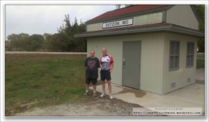
We took no trailhead pictures at Dutzow, opting to just grab them in the morning.
Shortly after our arrival our pickup arrived. I easily popped off my front wheel and both our bikes fit in the back. Riding the distance into Washington, I quickly became reassured we’d made the right choice. Much of the distance is on a surprisingly high traffic highway with little or no shoulder; and that bridge would have been a very uncomfortable bottleneck. Two lanes (one each direction) with zero shoulder would mean cars would either have backed up behind us or possibly worse, tried to skirt around us by inches. Too white-knuckle for me after this long, tiring, headwind day.
We arrived at the Super 8 in Washington, our final overnight stop on the Katy. As with the Baymont, they were kind enough to put our bikes in a locked room – a utility room on the ground floor (our room was on floor 2). Another cyclist had the same idea; his bike was in the room when we stowed ours. We dropped off our panniers and gear in the room and biked the short distance to a nearby Arby’s for dinner. This fortified Arby’s as a sort of Katy tradition for us; following our 50-mile Katy recon ride a few weeks prior, we’d eaten dinner at an Arby’s, which was the first time in probably decades I’d eaten there. Today was the second time in decades.
I had a heated turkey sandwich, curly fries and kettle chips. Great meal to end the day. As a guilty confession, we decided we’d earned a treat for our 70+ miles of headwind and stopped at the local DQ for a dessert. Back at the hotel, we watched the movie Christine for a while, imploring the characters on-screen with advice (“Don’t run into the alley you dummy!”) and soon enough shut it down for the night.
Roughly 190 miles were down with roughly 50 to go. Both of our long days were in the books, and the forecast promised much more of a tailwind than a headwind for the “short” finish into Machens.
Stay tuned for the final installment!
Katy Trail 2012, Day Two (Boonville to Jefferson City)
October 27, 2012
Day 1 (Clinton to Boonville) is posted here.
After a good long night’s sleep at the home of Mr. and Mrs. K in Boonville, Mr. V and I started stirring around 7:30 or so. Mrs. K, continuing her spoiling of us, had the day prior prepared some french toast that needed only to be heated up in the microwave, and had all the fixins – syrup, powdered sugar, etc – to add. Mr. V and I woke up to this (and myself with a cup of coffee), reviewing some final plans for the day’s miles while speaking with Mrs. K about the local area.
Finally around 8:20 or so, it was time to pack up and head out. As with the day prior, where Mr. C dropped us off from the warm van into the chilly Clinton morning air, so it was this morning. But the weather was favorable to our ride – each morning’s departure was to be a few degrees warmer than the prior morning. Combined with the little bit later start this morning, today wasn’t all that bad.
Above: Dawn breaks outside Mrs. K’s house, and with it the promise of another exciting day of discovery on the Katy Trail.
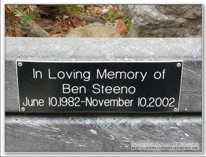
Above: The trail had a large number of benches placed for riders to rest or simply to relax and enjoy a beautiful view. Many of them were engraved with dedications, in most cases to a missed loved one. Although I didn’t and don’t recognize any of the names, I thought it a fitting tribute to capture most of them for this blog, which I’ve done. I didn’t get 100%, but I got a lot.
As mentioned in the day 1 post, Mr and Mrs K lived in Boonville just a couple miles ahead of the trailhead, so we didn’t reach that trailhead till today. And an awesome place it was! This along with Sedalia was easily my favorite trailhead-type stop of the trip, and I dare to speak for Mr. V in offering his concurrence.
This Boonville trailhead (actually just a little bit further east than the actual trailhead stops, above) also had a train car on a section of track – this one you could climb up in and look around – and it also had a small Katy Trail themed gift shop.
Above: We arrived just in time to see the trailhead/gift shop attendant attach and raise the flag for the morning. Beautiful site which I was glad to capture. I told her I’d done so, to make sure it was ok 🙂
Above: The train car at the Boonville depot.
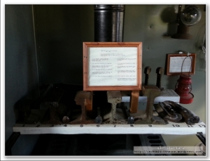
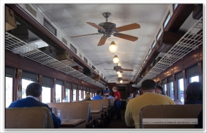
The train car was just simply cool. It was like its own little mini-museum of railroad history. Mr. V and I were like little kids on an easter egg hunt, running around looking at the various cool stuff – old railroad tools, chairs you had to climb up a narrow little set of steps to sit in, all kinds of contemporaneous little bits of history. We spent close to half an hour here before we even entered the gift shop.
Below follow several pictures from this cool place.
Above: The car had a guest book you could sign with your hometown of origin.
Finally we entered the gift shop and had a look around. Lots of cool stuff – I wanted to pick up one of just about everything! In the end I picked up a couple of beautiful Boonville postcards, a Katy Trail sticker, and a nice Katy Trail shirt.
Above: The gift shop had a map of the U.S. in which many pins were stuck by previous visitors, representing their city of origin. I dutifully marked my hometown, Ottawa (Kansas), being the first to do so.
The keeper of the shop, whose name I have alas forgotten (apologies!) was very informative as well as helpful to us. We talked with her for a while about the trail, where we’d come from & were going, etc. She and her husband had ridden on the trail previously and really enjoyed it. She provided some specific assistance to us which would come in handy later in our story. We were on the fence about our 3rd night’s stay in Washington – which isn’t on the trail directly but rather around 5 miles or so away. We’d been debating whether to ride the bikes there from the trail or take a taxi. Much online advice advocated the latter due to the bicycle-unfriendliness of the route. This lady in Boonville strongly supported that and generously looked around finding a couple contact numbers for us for taxi services in that area. This would later prove to be very useful to us.
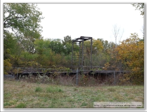
She also educated us, as had Mrs. K to some degree, on the local infighting regarding the 408-foot long Katy lift-span bridge which lies on the trail. Built in 1932 and at the time the longest lift-span bridge in the United States, this is a beautiful old bridge (several pics below here) which lies in the normal path of the trail but which for political and funding reasons is currently not available to trail travelers. The bridge is there but the accessways to it are removed. She explained that in time the bridge likely WILL be available to trail riders, but it was likely to be years away. Instead, while you can approach the bridge for pictures (which we did!) there’s a small detour around it to continue with the trail.
We thanked her for her time and help and the good info and got rolling again.
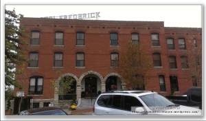
We’d made today a short day in order to allow us to spend a little extra time looking around, and we certainly took advantage in Boonville. We stayed a good long while at the Boonville station/museum; then, after departing there, we rode into Boonville proper for a look around and photographed a few beautiful buildings.
At this point I can say that the favorite stretch on the trail of both myself and Mr. V was the roughly 25-mile stretch from about Boonville to around McBaine – which is the first 25 miles we covered here on day 2. The landscape was incredibly beautiful, there were several interesting things to see along the trail both of architectural and natural origins, there was an amazing diversity of things to see and do and marvel at. I can heartily say that if you could pick any 25 mile stretch of the Katy to ride, this is where you want to go.
This jibes well with everything I’d read online, mostly at bikekatytrail.com. This is also my first time mentioning that site, but perhaps this late mention is an injustice. Bikekatytrail.com was a completely invaluable resource in our preparations and pre-ride research. It’s a labor of love which includes tons of info on the trail, towns along the trail, things to see and do, services available, you name it. Indispensable if you plan to hike or bike on the Katy or if you are just interested to learn more.
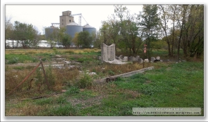
Above: At about milepost 189, these are the ruins of the Franklin Junction turntable. My comments from day 1 about the “old decaying, abandoned ghosts of machinery and engineering that one encounters along the way” is certainly applicable here as well. There is a sad kind of stoic beauty to this structure which I found very compelling.
Above: At the “Katy Roundhouse”, a campgrounds on the trail just before the New Franklin trailhead.
Above: I just found this interesting 🙂 It’s remarkable to think how different our modern life, filled with iPhones, 70-mph automobiles with air conditioning and heating, and wireless broadband internet is from the life our civilization, our species, lived not at all terribly long ago.
Above: The New Franklin Viaduct.
Above: At milepost 184.5. The boards at the trailheads give us: “The town of Pearsons had at least one store during its heyday. Now, just this old clay-tile grain elevator remains, the only one along the Katy.” Once again – once-functional and now long-abandoned ghosts from the past lining the trail. Very cool.
Above: The famed tunnel at Rocheport. From the Katy Trail trailhead boards: “Milepost 178.9 – This picturesque, cut-stone arched tunnel was built in 1892-93 and is 243 feet long. It was the only tunnel on the MKT line” … “At milepost 178.9 is the one and only tunnel on the Missouri, Kansas & Texas line. The blackened ceiling stands as a reminder of the trains that passed through this tunnel from 1893 to 1986. The tunnel is listed in the National Register of Historic Places.”
Below follow several pictures we took at a beautiful conservation area beside the trail just past the stone tunnel. This was an awesome place, with huge sprawling vistas, benches and chairs to sit, relax and contemplate, and stone steps winding up a hillside for higher and higher views.
We stayed here for several minutes admiring the beauty and capturing some pictures for the memory books. About here, though, we began to feel the pinch of time. While today was our short day, we’d set out somewhat later than usual and really taken our time at the various sites recapped here and, as evidenced by many of today’s pics, rain was a constant threat. We’d scanned the weather forecast and it appeared that rain was likely to arrive in Jefferson City, our stop for the night, somewhere around 6-7 PM. Accordingly we imposed on ourselves a requirement to arrive there by 5-6ish, which given the time we’d allowed ourselves at each of these cool places, meant that the tyranny of the clock pulled on us a little more strongly from here to day’s end.
We reached Rocheport trailhead. Such was our casual pace (stopping frequently and staying a while at many places) since starting out for the day that we took a few HOURS to travel these ~15 miles!
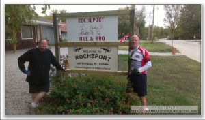
Above: We ate lunch at Rocheport Bike & BBQ. You work up quite an appetite riding the bike dozens of miles; I am not a fan of beans but I put down a double side-order helping of them along with my pork sandwich! Good food. This made 2 days in a row of BBQ for lunch; and Mr. V had actually had BBQ back in Overland Park on Tuesday, so needless to say he was BBQ’d out.
Above: The Ted Jones tribute at about milepost 189. The plaque, dated October 6th 1990, reads, “The Katy Trail State Park is in large measure the creation of the foresight, energy and generosity of Edward D. (Ted) Jones.” Ted Jones recognized in the proposed abandonment of 200 miles of the Missouri-Kansas-Texas railroad line between Sedalia and Machens, Missouri, the rare opportunity to create an extraordinary recreational trail winding through the lower Missouri River Valley, a place rich in history and natural beauty. His generosity made possible the acquisition of the railroad corridor and provided the materials to construct the entire trail surface. His tireless efforts went far to gain public support for the trail. From inception to construction, Ted Jones guided the Katy Trail State Park into existence. This trail, and the enjoyment and fulfillment it provides to all who use it, is respectfully dedicated to this exceptional citizen.”
I’ll second that!
Below: Ted and his wife Pat.
Above: The railroad’s former explosives storage bunker.
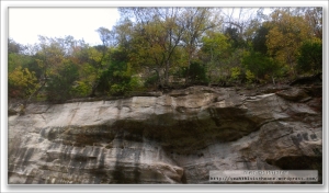
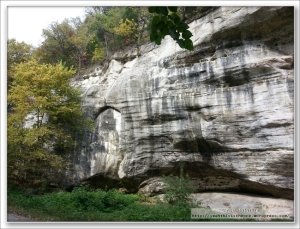
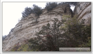
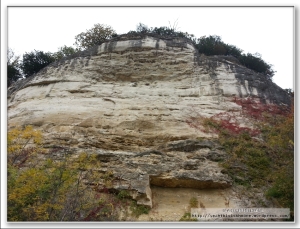
Below are several pictures of the bluffs on which (in this stretch) remains of Native American pictographs are still visible on the limestone bluff. The first picture illustrates some of the images that can (ostensibly) be made out – we were able to see a couple of these but not all of them.
Above: Possibly my favorite picture of this trip. When I think of encapsulating the grandeur of the trail and the attempt to sum up my memories of the trip in one single image, this is it. Several points along the trail offered these stunning towering-bluff views to the north of the trail; and coupled with the fall foliage in many sections, it was extremely beautiful.
Above: The state champion bur oak tree. It has a 91-inch-diameter trunk (yes – 7.5 feet), is over three hundred years old (i.e. older than the United States itself…amazing), and survived the flood of 1993. This thing was just unbelievably massive, as especially this picture shows. The Katy Trail runs within 1/4 mile of the tree. Just as we arrived at the tree, a girl and her boyfriend who’d ridden in from Columbia, MO to take pictures also arrived. She is the one in this picture; he took this photo, and the two of them took various of the photos that follow. We returned the favor!
We reached the McBaine trailhead.
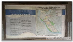
Above: At milepost 154.6, just before Hartsburg, this is the “bottomland agriculture” information stop.
Above: It wasn’t all fun and games 🙂 Actually, even though I look seriously ticked off in this picture, I didn’t feel that way during this entire trip, so I’m guessing I was just trying to determine if Mr. V was intending to take my picture or if I was blocking his shot of something else. But it makes for an interesting legacy picture from the trip.
Following are many pictures we took of the natural beauty between McBaine and Hartsburg.
We reached the Hartsburg trailhead.
Above: A train car visible from the Hartsburg trailhead.
By this point if not a little earlier, it was pretty clear we’d dodged the weather bullet. The rain that seemed to be threatening our arrival in Jeff City wasn’t imminent. We had about 10 miles to go to our final trailhead of the day, so roughly an hour on the bike plus time to look around, and we were feeling good that the weather was holding.
Above: Located at the North Jefferson trailhead, the plaque reads: “Here at the North Jefferson Trail Head, on Sept. 29, 1996, the east and west sections of the Katy Trail were joined, forging the final link uniting St. Charles and Sedalia via Katy Trail State Park.”
Indeed, North Jefferson, just outside the Missouri capital of Jefferson City, lies at more or less the halfway point on the Katy Trail. The mention of St. Charles is because until very recently, the easternmost terminus of the Katy Trail was St. Charles. In March/April 2011, the roughly 12 mile extension to Machens was completed.
Above: Info board about the Great Flood of 1993. Located just outside the North Jefferson Trailead.
Above: This innovative multi-level ramp takes cyclists (or pedestrians) up to a dedicated bicycle/pedestrian lane on the bridge into Jefferson City. This on-ramp was reached via a short, easy 5-minute ride from the trail.
Above: The Jefferson City capitol building, from the bridge.
Above: The dedicated lane on the bridge. Very cool arrangement; very convenient means to transport us from the trail right into Jeff City.
Above: We stayed at the Baymont in Jeff City. They let us put our bikes in one of their (locked) conference rooms for the night.
Above: We’d planned to just find a suitable place to eat dinner at Jeff City and hadn’t identified any particular place. At the suggestion of the desk lady at the Baymont, we ate at Arris’ Pizza on High Street, a short (but hilly! up two somewhat short steep hills) bike ride from the hotel. Delicious pizza here! Mr. V and I ordered a large meat lovers pizza (essentially – on their menu it’s called the Hercules) and, surprising even ourselves, put it down in no time.
We rode back to the hotel, watched some of the Vice-Presidential debate between Joe Biden and Paul Ryan, and shut it down for the night.
Two days of riding down…roughly 120 miles of the 240 on the trail done. Tomorrow (Friday) was going to be our longest-mileage day, at just over 70 miles.
Stay tuned for day 3!
Katy Trail 2012, Day One (Clinton to Boonville)
October 22, 2012
So I finally completed my major cycling goal for 2012 – biking the full length of the Katy Trail.
I should say “we”, as my oftentime cycling companion Mr. V joined me for the adventure. We’d been planning this more or less seriously for several months, and had started to really focus the plan over the past couple months. We initially thought we would go in mid-October; then it appeared circumstances favored an early November date; finally the original timeline was identified as being best. We planned a four-day ride starting Wednesday October 10th in Clinton, MO and riding east to end in Machens, MO on Saturday October 13th.
Top-line impressions: The trip went as planned; no major equipment or medical issues; no major weather (though it was dicey for one day). In the subjective-experience department: Wow. Wow. It’s not for nothing that bicycling.com named the Katy Trail as the best bike ride in Missouri as part of its top 50 rides in the US review. I’d done a fair amount of reading and preparation on the trail prior to our departure, but the actual experience surpassed every expectation I had. I – we – had an incredible time. We were already starting to miss it (in anticipation) on the final day well before reaching Machens. We hope to return next year – same-ish time – to ride the trail once again.
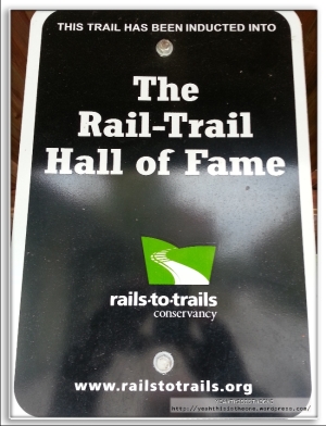
First a little backdrop. The Katy Trail is the country’s largest “rails-to-trails” bicycle/pedestrian trail. These are trails that are converted from former railroad lines. The trail takes its name from her ancestral railway line – the Missouri-Kansas-Texas Railroad, often shortened to “MKT” or simply “The Katy”. The trail is 237 miles long, stretching across most of the state of Missouri. Much of it follows Lewis and Clark’s path up the Missouri River. For much of the distance, and at intermittent points, the river flows to the south of the trail while much of the time, the trail’s north offers views of towering bluffs, open farmland, or wooded areas. The surface of the trail is covered in finely crushed limestone. The great majority of it is quite firm and feels similar to riding on concrete (not asphalt – picture concrete with a thin layer of fine sand atop it), although small stretches are slightly rougher.
For me, returning from the trail was like emerging from a wonderful swirl of sensory input and constant glimpses into the past. The major themes of awe-inspiring visions of nature; the railroad history whose spirit is woven into the trail; and the Lewis and Clark parallels were to weave in and out of the four days like a beautiful tapestry. The Katy is an incredible journey, one which I cannot strongly enough recommend to anyone.
We returned from the trip with many hundreds of pictures, which I have (though it may not be evident!) culled down to a smaller selection which conveys a taste of the experience. For simplicity, I’ll be posting about the journey in four distinct blog entries, one for each day.
Day 1 – Clinton to Boonville
Day 1 was one of our two “long days”. The itinerary we’d drawn up called for a ~70 mile day, then ~50 miles, then ~70, then ~50. This gave a nice rhythm to the journey – long day, short, long, short – but was mainly driven by the content along different stretches of the trail. There was plenty to see and do each day; but relatively speaking, day 1 offered less “stuff” than day 2, so it made sense to make hay that day and reserve some time for sight-seeing on day two. Add in that friends of Mr. V’s – Mr and Mrs. K – graciously agreed to put us up for the night in Boonville (about 70 miles in) – and day 1 was pretty set. Days 2-4 followed from there in the planning phase.
Mr. V and I live in Overland Park and Ottawa (Kansas) respectively, so just over an hour from Clinton, MO. A friend of ours agreed to drop us off in Clinton on Wednesday (thank you Mr. C).

Above: Mr. V in the warm van on the way to the chilly start in Clinton.
We arrived in Clinton about 7:30 AM. Mr. C dutifully took a “the journey begins” shot of us at the Clinton sign, then returned to his warm van and drove off.
Yes, the warm van. Mr. V and I were lulled to a false sense of comfort on the drive over. The outside temperature was around 40 degrees and, in that inimitable first-cold-weather-of-fall way, felt colder than that. It would warm up to palatable level within an hour or two, but the first hour was a chilly one.
We’d arrived prepared for the journey. We each had panniers on the bikes with a couple changes of clothes; poncho’s in the event of rain; some fuel/food for the journey; things like chapstick, toothbrush/toothpaste and the like, mobile phones with chargers, plus a couple spare tubes and various tools for common bike repair.
When we arrived at the Clinton trailhead, another couple fellas were just unpacking their bikes and getting ready to set out. Talking briefly to them as we all got things squared away, these guys had apparently also had this trip in mind for some time and were excited to finally be doing it. They were planning to go something like 110 miles this day – in order, they said, to take things slower when they entered wine country. They had experienced a flat before their ride got underway, but had taken care of that and were pushing off just before we did.
We filled up our water, got on the bikes and rode west. Yes, west – we were purists and wanted to truly do the trail end to end. The trail actually begins 1/2 mile or so west of the Clinton trailhead. We pedaled to the intersecting road there, got the “trail starts here” picture, and set off east toward Machens, 237 miles away.
Mr. V and I had previously been on the Katy only once. We’d made a recon ride here a few weeks earlier and gone about 50 miles – to Green Ridge and back. Therefore, over 1/3rd of today’s riding was not new to us, but from that point on everything would be. We spent the first hour or so in conversation and trying to keep our fingers warm on the handlebars. Not 5 miles in, we passed those same fellas we’d seen in Clinton – fixing a flat. Two flats in the space of basically a couple miles. They clearly had things well under control, so we wished them good luck and moved on.
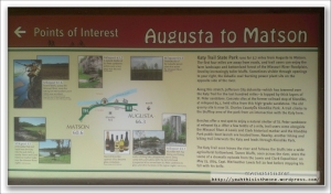
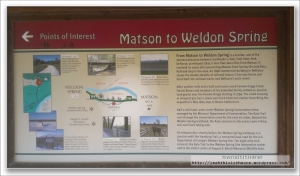
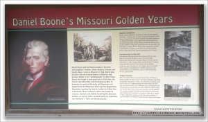
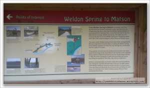
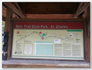
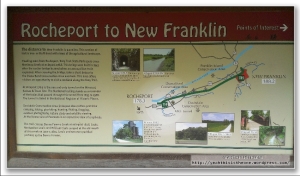
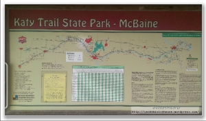
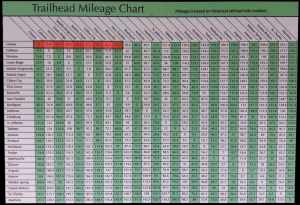
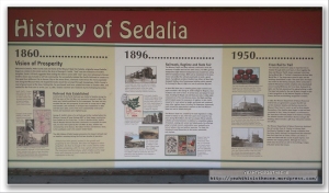
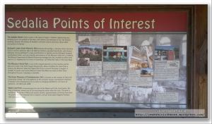
Below – one thing I am super impressed with is how well organized/how informative the Katy Trail is. It’s almost as much like riding your bike through a 240-mile museum complete with informative exhibit displays as it is riding on a bike trail. Essentially every trailhead (of which there was one on the average every 10-12 miles or so) contained panels very similar to the ones below – showing where you are, what is of interest between there and the next town west, same with the next town east, various bits of local history or interest, etc. Each contained a grid like the one which starts this post, showing mileage from every point on the trail to every other point. Everything on the trail is communicated in terms of mile markers – and the trail has one every mile of its length. This made it very convenient and easy to be on the lookout for things that interested you.

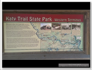

On our recon ride, Mr. V and I read many of these boards. But on this ride, we chose to simply photograph all of them to later fully read at our leisure – which at this writing I’ve not yet done but am really looking forward to. It’s my guess we will find many things here which will inform things to look for in our return next year which we might have overlooked this time.
Between Clinton and Calhoun, we didn’t take any pictures on this ride. It was because we’d already covered this ground in our recon ride; but I now regret not grabbing at least a couple shots for the blog.
From Calhoun to Windsor was about 7.5 miles.

Above: This is the Katy Trail Windsor Bicentennial train car at the Windsor trailhead. One of the handful of train cars parked on a section of track along the trail. At least one or two of these you could climb into (we did so in Boonville); but most you could not.
Above: There were several of these older telegraph / telephone polls just off the trail in this stretch as well as in a couple of stretches further down the trail. These were the old telegraph lines used to send signals from train station to station along the rail.
Above: Roughly 20 miles in from Clinton you reach the highest elevation point on the trail. There is a sign, an info board (below) and a couple benches here before you push on to Green Ridge.
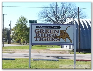
Above: Taken from the Green Ridge Trailhead.
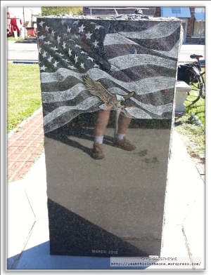
Near the trailhead, we decided to ride into & check out the little town of Green Ridge. Shortly after turning onto what appeared to be the main street, we found a little park with a lovely tribute to war veterans.
Leaving Green Ridge en route to Sedalia, we were officially in virgin territory. This took us past our recon ride of a few weeks before; the remaining ~90% of the trail would be brand new!
We’d decided to eat at Kehde’s BBQ (pronounced Katy’s, just like the trail) in Sedalia. A friend and coworker, BL, hails from Sedalia and offered this as her favorite place to eat in the town. It was a hop, skip and jump off of the trail – exiting the trail past the overpass (below), you walked down a hill and rode a short 1/2 mile or less on the sidewalk up to the restaurant.
It was a cool little place all right – TONS of trappings from the railroad history of the town. You had your choice of a traditional and comfortable seating area, chock full of railroad paraphernalia, or instead could climb a flight of stairs and eat in the “Kehde Flyer”, a long dining room in the form of a boxcar. We opted for the latter but grabbed many pictures of the decor on the lower level.
This was a very cool place with an awesome reverential vibe for the railroad era past, and the food was wonderful too. Good call BL.
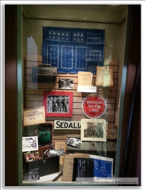
Leaving Kehde’s, we returned to the trail and continued. Shortly before the actual Sedalia trailhead was one of the handful of fully-restored train depots along the trail. This was easily (along with Boonville) one of the two coolest trailhead-type stops on the trail, and we spent some time looking around the combo shop/museum. Tons of pictures from the railroad museum follow.
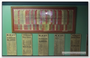
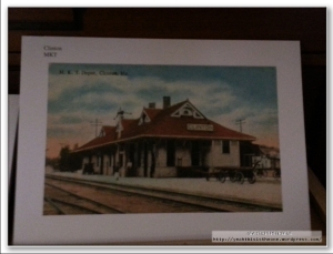
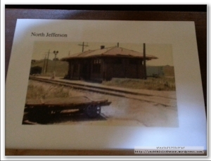
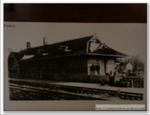
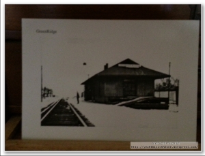
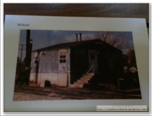
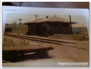
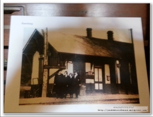
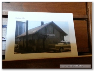
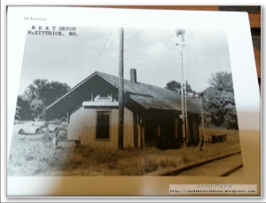
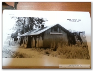
Below: This is possibly my favorite part of the Sedalia museum, although I found all of it very cool. They had a display in a middle room with more-or-less postcard-sized pictures of, near as I can tell, the train depot at EVERY town along the trail. It was a strange sensation looking at all these older pictures from a bygone age, of all these towns which I’d seen in my research for this ride and through which we had been, and would be, riding as part of the journey. This was something I found extremely cool.
In addition to the awesome museum, the Sedalia station housed a Katy Trail-themed gift shop, at which I bought myself a sharp Katy Trail hat.
Shortly past this place was the actual Sedalia trailhead.
When leaving Sedalia we crossed paths with two other cyclists, younger guys. We cordially nodded here in Sedalia, and saw them on the trail headed in the same direction we were; we otherwise thought nothing of it till we saw them again while going through our trailhead routine at Clifton. They, too, pulled in and we all talked for a little while. Turns out they had ridden the full trail in the other direction, turning around at Clinton and coming back, over the course of a week or so. They’d ridden the Katy Trail or portions of it many times, and this time they were actually camping versus staying in hotels. They were hauling comparable gear to myself and Mr. V but with the addition of camping gear – tents and cooking utensils. Nice guys; they were taking their time so we also made it to Pilot Grove before they did, but they again arrived before we left and we chatted a while again. We didn’t see them again the remainder of that or the next day.
From Sedalia we rode another 14.5 miles to Clifton City.
From Clifton City to Pilot Grove was about 12 miles.
A word here about elevation on the Katy Trail. The direction in which we were riding, west to east, is the easier of the two directions. The trail, running along an old rail line, has no dramatic elevation changes over its course; but in general, the elevation does decline from west to east.
An interesting aspect of our itinerary is that nearly all the major (relatively speaking) elevation changes occurred in day 1. From Clinton to Calhoun is gradually descending. From Calhoun to the high point is gradually ascending (with some variation); the trail is fairly level to Sedalia; then there’s a nice descent into Clifton City, prior to a nice climb up into Pilot Grove. From Pilot Grove to Boonville, where we stopped on the first night, is a nice descent. Starting on day 2 and going to trail’s end, the elevation is essentially flat, but there is a gradual downward grade.
Above: At milepost 213.2, this is one of the few original signal lights standing on the Katy Trail. Seeing this, as with several other things on this journey, was very much like stepping out of a time machine into an older day. It strikes me in a way I cannot adequately verbalize, how remarkable it is that we are standing at the same precise “coordinates” in a spatial/geographic sense but yet removed in time from this bustling older era of rail travel over this line. It was a sensation that I was to experience again and again over these four days. These old decaying, abandoned ghosts of machinery and engineering that one encounters along the way stand in mute testimony – perhaps a little sad if you can forgive the literary license – to a different time.
About another 10 miles beyond this signal light was the Pilot Grove Trailhead.
As mentioned earlier, friends of Mr. V were putting us up for the night. They actually lived just north of the trail a mile or two before the Boonville trailhead, so Pilot Grove was the last true trailhead for the night. We hopped off the trail and had a short run-up west and north to our waiting host and hostess.
Above: Mrs. K (picture taken the morning of day 2).
Our gracious hosts Mr. and Mrs. K were beautiful people, who as my mom used to say, spoiled us something fierce. We arrived in time to eat a freshly-cooked chicken-and-rice meal with tomato sauce and fried apples (we both had seconds of everything!); and for dessert was some kind of pie (I’m not an expert, but it was fabulous) warmed in the microwave and topped with vanilla ice cream. Heavenly end to a long ~70 mile day for two tired but enthusiastic riders.
A heartfelt and sincere THANK YOU!! to Mr. and Mrs. K for their gracious hospitality!
They had two guest bedrooms ready for us; I hit the sack pretty early, maybe 8:30 PM; as I understand, Mr. V followed suit less than half an hour later. We were able to get a good long night’s rest prior to day two – our “short day” mileage-wise but with much cool stuff to see.
Stay tuned for day 2!
Pushing Gears, Facing Fears
April 16, 2012
Some time ago, fairly early in my cycling days, I bit off more than I could chew at the time. Way more.
I tried to attack the rolling hills that present themselves on Highway 59 north of Ottawa. To an experienced rider – or someone with better cardio than I had (which isn’t a tall order) – those hills are manageable. Or even someone in my then-shape, but with good riding strategy (smart gear-shifting, keeping energy replenished), would be ok. But, in what was destined to be a big-time learning experience for me, I charged ahead, very out of shape, with little energy in the tank, with little concept of gearing strategy, and with a full head of steam.
3/9/2012 Hwy59 Ride (Images from the Road)
March 10, 2012
Been light on updates lately. A combination of work, uncooperative weather, and a brutal cold/ear infection has kept my riding time very limited the last couple weeks. But, I’m still around and still focused on the big goals 🙂
Yesterday I got in a good 18.2 mile ride south on Highway 59, my favorite local route.
I’ll blog a little more later about this ride – because it marked an evolution in “the strategy” – but for now, suffice for some “images from the road” along with my attempt at artistic expression of the range of feelings created by bicycling.


