Katy Trail 2012, Day Three (Jefferson City to Washington)
October 28, 2012
Day 1 (Clinton to Boonville) is posted here.
Day 2 (Boonville to Jefferson City) is posted here.
My experience and that of Mr. V overlapped to a remarkable extent during the 4-day trip. Even though day 2 was possibly our shortest day, both of us were actually more tired at the end of day 2 than we were to end any of the other days. Several reasons were posited, but it’s nice to speculate on it now, in the comfort of hindsight. At the time, living the reality, I arrived at Jeff City on not too much more than fumes and was internally (and quietly!) wondering how on earth I could swing the roughly 75+ miles which day three would require if I was feeling like this now.
Fortunately, time, a good night’s sleep, a good fueling strategy and determination cures many ills. I woke up on day 3 feeling refreshed and, having calculated my remaining miles versus remaining fuel, determined I’d budgeted my fuel conservatively on days 1-2 and could open up a little bit as needed. Day 3 in particular was going to be a long one, so I decided early to not play around and instead make sure I stayed very well hydrated and fueled. This was going to be trickier than I bargained for, as will be revealed.
Above: A nice big breakfast (continental breakfast at the Baymont) to start the day. I had already discovered one of the special joys of bicycle touring – your metabolism goes through the roof; you can eat generous meals and still (if appropriate, as in my case) lose weight.
Above: After breakfast, Mr. V and I wiped down and re-oiled our chains in the Baymont’s conference room, for the long day ahead. We were planning to re-oil the chains following each day of riding (as bikekatytrail.com rightly says, you and your bike WILL get dusty from the limestone trail dust) but both our bikes were still in good enough order after day 1, so that this is the first time we maintenanced them on the road.
Above: The dawn of another beautiful day…ready to hit the Katy Trail once again.
Above: The capitol building.
Above: A look down High Street toward where we’ll get back on the dedicated lane on the bridge and then ride the short few minutes back to the North Jefferson Trailhead.
Above: Katy Trail, day 3. 120 miles down, 120 miles to go.
We reached Tebbetts.
Both Mr. V and I look back on this day 3 as being the sheerest test of our resolve. For myself – our on-bike styles differ. I drink a lot of water. A LOT of water. I’m one of those cyclists for whom feeling comfortable on longer rides centers around good hydration. A friendly warning for those riding the end-to-end Katy – the water accommodations at the trailheads are much different on the eastern half (past Jefferson City) than the western half. While essentially every trailhead west of Jeff City (roughly every 9-12ish miles) has water, almost NONE of them east of Jeff City do. Specifically in the ~70 miles of our day 3, there was water at the North Jefferson trailhead (start of day) and then again at the Marthasville trailhead 66 miles away (end of day). No trailhead in between had water.
This isn’t some desert, of course – the informed cyclist has a few choices: Carry additional hydration with him/her relative to his/her habits, and/or stop at local businesses to request of those folks kind enough to top you up.
I hatched a plan to work with the water situation. Mr. V offered me one of his water bottles at Tebbetts (dude is a machine – I swear he can go 100 miles on 9 oz of water and one energy bar) but I declined his selfless offer. I imposed upon the very kind folks at some kind of mill to the south of the Tebbetts trailhead for some water. Luxury – they had a beautiful water cooler in the office and let me refill my two large (about 52 oz total) bottles. This would hold me till our lunch stop, where I’d refill again which would hold me till Marthasville.
The other factor testing our resolve today would be the wind. We’d eyed the 10- and 5- day forecast in advance of the trip and saw that this day 3 would be the hardest in terms of wind. A fairly respectable and building wind from the north and east – acting as a direct headwind at times and cross-headwind at others – would be in our face most of the 70 miles. As though to pile on, much of today’s 70 miles would be the most prolonged open stretches on the trail – several long stretches with either no tree cover at all, or no tree cover to the east, from which the wind was coming. The wind was never strong enough to make you actually stop or truly slow your progress in a critical way – but it was just strong enough to grind on you all day long and wear you out.
We reached the Mokane trailhead.
Above: Spider on the trailhead building at Mokane.
We didn’t take a tremendous number of pictures today, especially as compared with day 2. A combination of the long mileage ahead of us and the pitiless wind kept us in the saddle just putting one pedal ahead of the other.
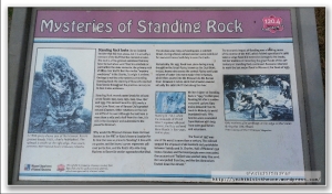
Above: At mile marker 120.4 is Standing Rock. This was another of the really awesome “time capsules” one encounters again & again on the Katy. I found it fascinating for many reasons. The board reads:
“Standing Rock looks like an isolated boulder that fell from above, but it is actually a remnant of the bluff that has resisted erosion. The rock is a fine-grained sandstone that may have formed when sand filled in a sinkhole or joint within the older dolomite, the primary rock of these river bluffs. But like similar ‘mystery sandstones’ in the Ozarks, its origin is unclear. Geology is not the only mystery surrounding Standing Rock: the identity of those who marked flood levels throughout the previous century on its face is also unknown.
Standing rock records water levels for at least seven floods: 1903, 1923, 1935, 1943, 1944, 1947 and 1993. The earliest record in 1903 marks a major June flood, one of Kansas City’s greatest natural disasters. Other notations on the rock are difficult to read. Although the trail here is more than a mile and a half from the river, it is still in the floodplain and vulnerable to the powerful Missouri.
Why would the Missouri-Kansas-Texas Railroad (known as the MKT or Katy) choose a location for its line that was so prone to flooding? A line with no grades and the fewest curves represents railroad perfection, and the Katy’s 165-mile-long Machens to Boonville section approaches that ideal.
The decision was risky, as flooding was a constant threat. During a flood, railroad workers were mobilized for near-continuous hard duty to save the tracks.
Remarkably, the 1935 flood took place during a long drought on the Great Plains, known as the Dust Bowl. In 1935, heavy rains across the central Plains sent large volumes of water into every major river in Kansas, which then poured into the Missouri via the Kansas River. Between 6 inches and 6 feet of water covered virutally the entire MKT track along the river.
Writter higher on standing rock is ‘1943’. In that year, flooding hit after a sudden snowmelt upriver. Katy trains detoured from St. Louis to Moberly to avoid inundated track. Fifty families were evacuated from Mokane with help from state guardsmen and volunteers.
The flood of 1947 was one of the worst in more than a century. The railroad stopped the shipment of all livestock and perishables between Sedalia and St. Charles. Half of Mokane’s 550 homes flooded, and hte townspeople were evacuated. One account said ‘ballast was washed away like sand. Rail was pulled from ties, and the ties themselves floated down the stream.’
The economic impact of flooding was a leading cause of the demise of the MKT, which folded operations in 1986 when a large flood did extensive damage to the tracks. Yet the tradition of recording the great floods of the 20th century on Standing Rock continued. Someone returned to mark the last major flood in Missouri, the flood of 1993.”
It was incredible standing next to this rock and seeing the marked flood levels, most of which were above our heads. Amazing.
We reached Portland.
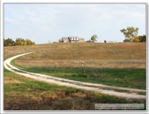
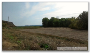
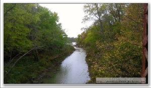
From Portland to McKittrick was 15 miles. Some beautiful area to be sure. We danced with the river to our south for stretches, intermittently with stretches of open area. The latter featured very wide-open country with far-ranging views. As at several other points during the 4 days, occasionally one of us would point to a house high on a bluff or on a hillside and say “how would you like the view these guys have every day?” Beautiful area.
Around here I started to struggle with the only “uneasy” feeling of the journey. I’d been drinking lots of water and, although I take electrolyte supplements on rides, it was not quite enough. I started to feel light-headed, drifty, spacy. From plenty of previous rides I recognized the symptoms and told Mr. V I needed to take a short break. On a short wooden bridge I munched a few wheat peanut butter sandwich crackers and took another electrolyte supplement. Mr. V took the occasion to take 3 more pretty pictures.
We pushed on. I was feeling much better within minutes and didn’t struggle again with this the remainder of the week.
Above: We stopped for lunch at the Trailside Bar & Grill in Rhineland. Another of the many towns not represented with a trailhead, it is nevertheless just off the trail. Trailside had a fantastic “ground game” of advertising – they had a flyer on several of the trailheads leading up to Rhineland in both directions. Mr. V was just happy to not have BBQ after having it for 3 straight days! I seem to recall that I had a bacon cheeseburger with fries and a side order of fried mushrooms, with lemonade. Heavenly. Very good food here and good service.
This place was a fulcrum of my hydration plan described earlier. The shopkeeper kindly topped off both of my water bottles (and those of Mr. V) and from their very basic grocery area I bought an additional 1-liter of bottled water. I was now comfortable that I’d be well covered for water through to Machens. I’ve continued to carry the additional 1-liter bottle with me on longer rides as well. Water on long rides is my security blanket 🙂
We reached the McKittrick trailhead.
Above: A unique vehicle parked at the McKittrick trailhead. Another couple arrived; we thought perhaps they were the owners but they weren’t and also were eyeing the interesting vehicle, which became a topic of discussion. We never saw the owners.
Above: A building near the McKittrick trailhead.
From McKittrick to Treloar was about 16 miles.
We reached Treloar’s trailhead.
Above: What jumped out at me was the population of Treloar. 60 souls live in this tiny town. Makes my hometown of Ottawa, Kansas a thriving metropolis by comparison.
Above: The “Bank” and the Treloar Mercantile Company. Here, as on many occasions across the 4 days, Mr. V and I remarked how these little towns along the path of the former Katy railroad were once vibrant little communities, at least by comparison with today. Now little remains of so many of them. Several, which I’ve not remarked on in this blog, are represented by a lonely green sign along the Katy Trail indicating you’re passing by/going through a tiny town just off the trail.
From Treloar to Marthasville was a short 7-mile run.
Above: If I have any regrets from the trip, I have only one: I didn’t key in keenly enough on the Lewis & Clark tie-in with the Katy. I stopped and observed many if not all of the marked sites, but I didn’t read most of the info boards and even failed to photograph some of them. There was tons to take in and do on this trip and I let this aspect take a back burner. Happily, we’re planning to return again in 2013, at which time I will more fully take in and appreciate this aspect of the journey.
At Marthasville (if I recall correctly) is when we made the final decision to go with a taxi service from Dutzow into our night-3 stopping point of Washington. Washington isn’t located directly on the trail – rather it’s about 5ish miles off the trail, with most folks using Dutzow as the jumping-off point. I’d read online that the consensus was that it was safest/best to have a taxi service pick up you/your bike and transport you into Washington, primarily on account of the bridge into town which is very narrow, with no shoulder at all, and surprisingly high trafficked for this area (it’s a highway, which explains much). Mr. V and I had gone back and forth on this point but nearing the end of this 70+ mile day, and with the advice of the lady at the Boonville station weighing on our minds, we went with the taxi service whose number she’d kindly given us. We called the guy, who drove a Ford Explorer which could fit a couple bikes, and arranged a pickup at Dutzow trailhead, then bicycled the ~4 miles there from Marthasville.
We took no trailhead pictures at Dutzow, opting to just grab them in the morning.
Shortly after our arrival our pickup arrived. I easily popped off my front wheel and both our bikes fit in the back. Riding the distance into Washington, I quickly became reassured we’d made the right choice. Much of the distance is on a surprisingly high traffic highway with little or no shoulder; and that bridge would have been a very uncomfortable bottleneck. Two lanes (one each direction) with zero shoulder would mean cars would either have backed up behind us or possibly worse, tried to skirt around us by inches. Too white-knuckle for me after this long, tiring, headwind day.
We arrived at the Super 8 in Washington, our final overnight stop on the Katy. As with the Baymont, they were kind enough to put our bikes in a locked room – a utility room on the ground floor (our room was on floor 2). Another cyclist had the same idea; his bike was in the room when we stowed ours. We dropped off our panniers and gear in the room and biked the short distance to a nearby Arby’s for dinner. This fortified Arby’s as a sort of Katy tradition for us; following our 50-mile Katy recon ride a few weeks prior, we’d eaten dinner at an Arby’s, which was the first time in probably decades I’d eaten there. Today was the second time in decades.
I had a heated turkey sandwich, curly fries and kettle chips. Great meal to end the day. As a guilty confession, we decided we’d earned a treat for our 70+ miles of headwind and stopped at the local DQ for a dessert. Back at the hotel, we watched the movie Christine for a while, imploring the characters on-screen with advice (“Don’t run into the alley you dummy!”) and soon enough shut it down for the night.
Roughly 190 miles were down with roughly 50 to go. Both of our long days were in the books, and the forecast promised much more of a tailwind than a headwind for the “short” finish into Machens.
Stay tuned for the final installment!


